
Surveying, Mapping and Geographic Information · Surveying and Geomatics
Water and Underwater Surveying
Surface navigation, underwater imaging
An unmanned surface vessel equipped with depth-sounding and positioning sensors collects underwater topography data, while an underwater robot performs close-range inspections of key areas. The results are integrated with shoreline data to generate a complete survey map.
BackSurveying, Mapping and Geographic InformationAll Solutions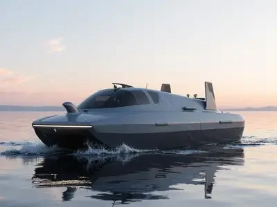
What's included in this plan?
The solution configuration maps to specific brands and product pages available on the site, with options to scale features up or down based on project size.
6{0} product lines /3Applicable use cases
Use Cases
Deliverables
- Survey Area and Flight Line DivisionSurvey Area Zoning and Flight Path Coverage Design
- Device CalibrationOn-site calibration records for measurement and sensing equipment
- Underwater Topography and Sonar ResultsUnderwater Topography Data and Sonar Imagery Results
- Coastline Stitching and Coordinate UnificationCoastline data stitching and unified coordinate transformation
- Technical Summary ReportProject Implementation Process and Technical Conclusion Summary
From a single point to an entire area
Progress in four stages: on-site confirmation, list configuration, implementation integration, and training handover. Maintain records for each stage.
4implementation phase
STEP01
On-site Requirement Confirmation
Confirm the locations, quantities, and existing system status for scenarios such as reservoirs and lakes, ports and waterways, bridge piers, and dams.
STEP02
Inventory and Configuration
Output a table listing model numbers, quantities, installation locations, and interface mappings to clearly identify add-ons and optional configurations.
STEP03
Implementation and Integration
Complete installation, configuration, and system integration per the "Deliverables" section, retaining all debug logs.
STEP04
Training and Handover
On-site training and daily maintenance, including account handover, configuration documentation, and spare parts list.
Surveying, Mapping and Geographic InformationRest of the industry2package
Other solutions within the same industry can be combined based on project scope.

Real-world 3D and Oblique Photography
A five-lens oblique camera mounted on a multi-rotor platform captures images from multiple angles. Aerial triangulation generates real-world 3D models and orthophotos, with optional output of DSMs and individual building models.
6{0} product lines ·5DeliverablesView plan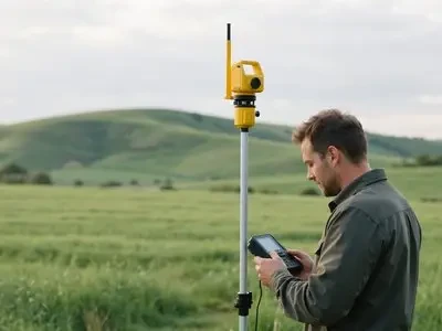
High-Precision Engineering Surveying
RTK and total stations complete control surveying and construction staking; 3D scanners capture existing structural surfaces, with results directly importable into design software for collision detection.
5{0} product lines ·5DeliverablesView planNeed a cross-industry portfolio? ViewAll Solutionsor directlyContact Us。
Similar Project Cases
andSurveying, Mapping and Geographic InformationView delivered projects in your industry, including on-site scenarios, equipment used, and implementation results.
