 Software Services
DJI Terra
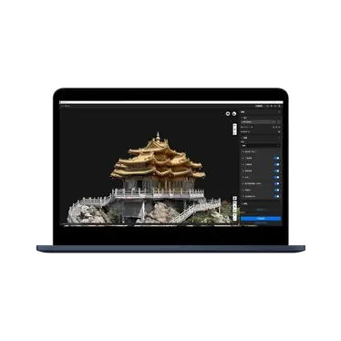
A 3D modeling software integrating next-generation reconstruction technology. It supports 3D Gaussian Splatting, visible light 2D/3D reconstruction, multispectral reconstruction, cluster-based reconstruction, and DJI LiDAR data processing for city-scale large-scene reconstruction. Paired with DJI drones, it delivers an integrated hardware-and-software aerial survey solution covering data collection, processing, and application.
Core Specifications
Product Video Introduction
Video sourced from the official DJI product page for reference.DJI Terraappearance and core functionality
* The video is an official DJI product video for reference on product form and features; actual configuration and pricing are subject to inquiry results.
Full Specifications
| Product Type | 3D Modeling Software |
| Reconstruction Technology | Supports 3D Gaussian Splatting, visible light 2D/3D reconstruction, multispectral reconstruction, and cluster reconstruction. |
| Data Processing | Supports DJI LiDAR point cloud data processing for large-scale urban reconstruction. |
| Data Insights | Provides universal data outputs compatible with GIS, CAD, and other industry software. |
| Export Format | PNTS / LAS / LAZ / PLY / PCD / S3MB |
| Complementary Solutions | Software and hardware solution integrated with DJI Enterprise drones |
| Version | Choose from multiple versions to match your reconstruction scale and precision requirements. |
* Specifications are sourced from DJI's official product page; actual configurations may vary by factory. Prices are subject to inquiry.
Download Product Brochure
Below isDJI TerraProduct Brochure Preview: Click the button to generate and download a PDF version for internal review and selection archiving.
A 3D modeling software integrating next-generation reconstruction technology. It supports 3D Gaussian Splatting, visible light 2D/3D reconstruction, multispectral reconstruction, cluster-based reconstruction, and DJI LiDAR data processing for city-scale large-scene reconstruction. Paired with DJI drones, it delivers an integrated hardware-and-software aerial survey solution covering data collection, processing, and application.
| Product Type | 3D Modeling Software |
| Reconstruction Technology | Supports 3D Gaussian Splatting, visible light 2D/3D reconstruction, multispectral reconstruction, and cluster reconstruction. |
| Data Processing | Supports DJI LiDAR point cloud data processing for urban-scale large scene reconstruction. |
| Data Results | Provides universal data outputs compatible with GIS, CAD, and other industry software. |
| Export Format | PNTS / LAS / LAZ / PLY / PCD / S3MB |
| Complementary Solutions | Integrated hardware and software solution with DJI enterprise drones |
| Version | Choose from multiple versions based on your reconstruction scale and accuracy requirements. |
Brochures are generated in real-time from page content. If your browser blocks the download, allow pop-ups and try again.
- Professional Scenario Selection Guide
- Customer Service Hotline 4006068166
- Building 7, Compound 2, Guanghua Road, Chaoyang District, Beijing
Purchase Intent
Submit your requirements and contact details. A sales consultant will confirm pricing, stock availability, and delivery options with you. Product prices are subject to quotation.